How Unmanned Aerial Systems (UAS) Are Transforming Risk, Enhancing Efficiency, and Delivering the Ultimate Data Platform
A decade ago, the sight of a drone hovering overhead was a curiosity—a futuristic toy belonging primarily to hobbyists or high-budget film sets. Today, that curiosity has matured into a cornerstone of modern industrial operations. The drone, or Unmanned Aerial System (UAS), is no longer just a flying camera; it is a meticulously engineered, data-harvesting platform equipped with the “Eyes in the Sky.”
From detecting minute thermal anomalies on a solar farm to generating centimeter-accurate 3D models of construction sites, drone camera systems have ushered in a new era of safety, precision, and efficiency. This revolution is fundamentally changing how we build, farm, inspect, and respond to emergencies, turning high-risk, time-consuming tasks into streamlined, digital processes.
The Technological Leap: Beyond the Basic Lens
The transformation of the drone from a consumer gadget to an indispensable industrial tool is rooted in significant advancements in sensor technology and stabilization. These systems are far more complex than the 4K video cameras commonly used by enthusiasts. Industrial drones utilize specialized payloads tailored to specific needs:
- Thermal Imaging: Crucial for inspections, detecting heat signatures indicative of equipment failure, leaks, or electrical faults, all without physical contact.
- Multispectral and Hyperspectral Sensors: Used primarily in agriculture and environmental monitoring, these sensors measure light reflectance across specific wavelengths, revealing data invisible to the human eye (e.g., plant health, soil moisture).
- LiDAR (Light Detection and Ranging): Essential for generating highly accurate, dense point clouds for 3D modeling and mapping, particularly effective when penetrating vegetation or performing volumetric surveys.
- High-Zoom Optical Cameras: Providing up to 180x zoom, these allow inspectors to view detailed structural integrity from a safe distance, making the assessment of bridges, towers, and power lines feasible and safe.
These sophisticated eyes, combined with advanced GPS and highly stable flight control systems, ensure that the data collected is not just picturesque, but geometrically precise and actionable.
Industry Deep Dive: Where the Skies Deliver
The impact of drone camera applications spans virtually every major economic sector, but five areas are experiencing the most profound transformation.
1. Construction and Infrastructure: The Digital Twin Revolution
Construction has traditionally relied on manual site visits and time-lapsed photography for progress tracking. Drones have condensed days of labor into hours of flight time.
Applications:
- Progress Monitoring and Reporting: Daily flights capture high-resolution imagery used to create orthomosaic maps—geometrically corrected photo maps of the entire site. These are used to compare actual progress against BIM (Building Information Modeling) plans, identifying delays early.
- Volumetric Calculations: LiDAR and photogrammetry drones accurately measure stockpiles of aggregate, dirt, or construction materials, providing near real-time inventory management.
- Safety and Inspection: Drones equipped with high-resolution cameras inspect critical structures like bridge beams, high-rise facades, and roofing. By eliminating the need for scaffolds, cranes, or rope access teams, drones drastically improve worker safety and cut inspection costs by up to 50%. The resulting images are highly detailed and permanently archived for regulatory compliance.
2. Energy and Utilities: Enhancing Safety and Reliability
The energy sector—covering oil and gas, solar, wind, and transmission lines—is characterized by vast, remote, and often dangerous assets. Drones are the perfect solution for routine, detailed inspection.
Applications:
- Wind Turbine Inspection: A full manual inspection of a single wind turbine can take an entire day and requires specialized rigging. A drone can perform the same detailed inspection (capturing blade fatigue, paint chips, or signs of lightning strike damage) in under an hour, dramatically reducing downtime and exposure risk.
- Solar Farm Assessment: Thermal cameras mounted on drones scan thousands of solar panels rapidly, identifying non-functioning cells (hot spots) caused by manufacturing defects or debris. This enables immediate, targeted maintenance rather than blanket inspections.
- Power Line and Pipeline Monitoring: Drones track the integrity of long-distance assets, looking for corrosion, vegetation encroachment (a major cause of wildfires), or infrastructure damage in inaccessible terrain.
3. Precision Agriculture: Farming with Geometric Precision
For centuries, farming has been based on generalized resource application. Drone camera applications are ushering in Precision Agriculture, treating every square foot of a field according to its specific needs.
Applications:
- Crop Health Analysis: Multispectral sensors measure the amount of light reflected by crops, providing data on chlorophyll levels and overall plant vigor (often visualized via the NDVI index). This identifies nutrient deficiencies, pest infestation, or irrigation failures before they are visible to the human eye.
- Variable Rate Application: By mapping localized stress, farmers can instruct automated machinery to apply fertilizer, water, or pesticides only to the specific areas that require it, saving enormous costs and reducing environmental impact.
- Yield Prediction and Scouting: Drones provide accurate plant counts and stand analysis, helping farmers predict yields and make timely decisions about harvesting or replanting.
4. Film, Media, and Mapping: Views That Were Once Impossible
While the entertainment industry was an early adopter, industrial mapping and cinematography heavily rely on the unique perspectives drones offer.
- Cinematography and Broadcasting: Drones provide smooth, sweeping, and dynamic shots previously only achievable with expensive helicopters, democratizing high-quality aerial visuals for everything from blockbusters to local news reporting.
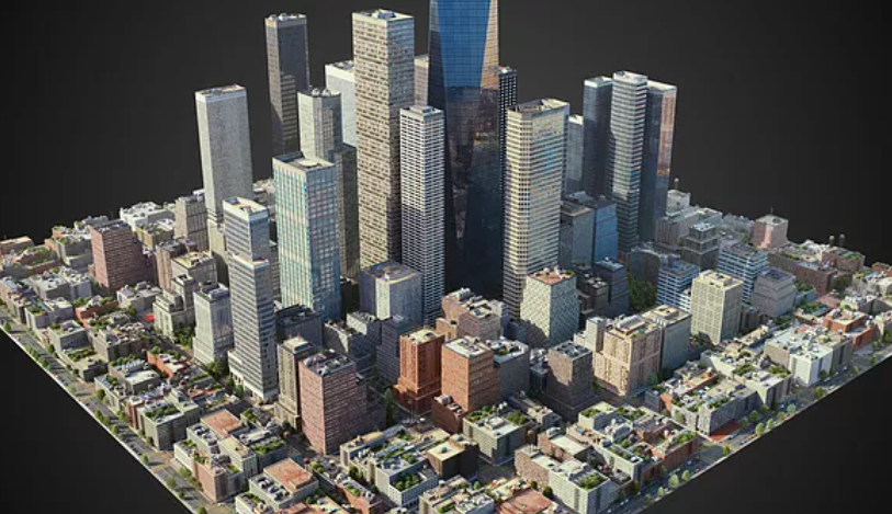
- Surveying and Mapping: Drones utilizing photogrammetry software replace traditional fixed-wing aircraft for small-to-medium-scale mapping, providing high-resolution aerial imagery and digital terrain models (DTMs) faster and cheaper than ever before. This is vital for urban planning and real estate development.
5. Public Safety and Emergency Response
In critical scenarios, speed and situational awareness save lives. Drones provide real-time intelligence without risking rescue personnel.
- Search and Rescue (SAR): Thermal cameras quickly scan large, inaccessible areas (forests, mountains) for lost individuals, especially in poor visibility conditions or at night.
- Firefighting: During large-scale events, drones deliver live video feeds and thermal maps, allowing commanders to understand fire spread, pinpoint hot spots, and safely deploy resources into smoke-filled environments.
- Hazardous Material (HAZMAT) Incidents: Drones can safely approach and inspect damaged industrial sites or chemical spills, gathering crucial data while keeping humans out of harm’s way.
The True Revolution: Data, Not Just Photos
The most significant shift is recognizing that the drone camera is merely the collector of raw data. The transformation happens downstream, in the processing stage.
High-definition aerial imagery is processed using sophisticated software to create digital twins—perfect, measurable mirrors of the physical world. Photogrammetry converts thousands of overlapping 2D images into precise 3D models and point clouds.
Furthermore, machine learning and Artificial Intelligence (AI) are analyzing this data stream autonomously. AI algorithms can be trained to automatically identify anomalies—a missing bolt on a pipeline flange, a crack wider than a predetermined threshold on a bridge deck, or a specific weed species in a field. This automated analysis transforms millions of pixels into clear, immediate, and actionable maintenance reports.
Navigating the Future Skies
While the revolution is well underway, the industry still grapples with regulatory complexity (particularly airspace restrictions enforced by bodies like the FAA), battery life limitations, and the massive data storage requirements generated by gigapixel surveys.
However, the future promises even deeper integration. We are moving toward fleets of highly autonomous drones capable of coordinating missions and sharing data instantly. New sensor types, improved endurance (possibly via hydrogen fuel cells), and greater integration into standard enterprise resource planning (ERP) systems will solidify the drone’s position.
The Eyes in the Sky have proven their worth, transforming dangerous, inefficient, and costly tasks into precise, safe, and data-rich operations. These systems are not just improving existing processes; they are enabling entirely new possibilities, proving that the sky is no longer a limit, but the ultimate vantage point for industrial growth.